The Rising Incidents of Cloudbursts in 2025 — Intensified Monsoon or Climate Change?
The increasing frequency of cloudbursts in 2025 has raised critical concerns—are these extreme weather events driven by an intensified monsoon pattern or are they a direct result of accelerating climate change?

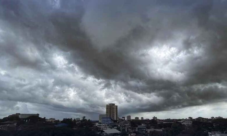
Beware — this is not just an ordinary rain or regular clouds; it could be a cloudburst. Yes, the ongoing monsoon season is quite different this year, and reports of cloudbursts are being heard more frequently than usual. But what makes this monsoon different? What exactly is a cloudburst? What are its causes? What kind of damage can it cause? Are there different types of clouds too?
READ MORE: Let’s Save Our Green Future
These are the kinds of questions people are casually asking everywhere these days. To find answers once again this season, I reached out to NDMA Technical Expert Dr. Tayyab, to gain a complete understanding of the issue.
Let’s begin with the monsoon, which officially started this year on June 25. As time passed, the monsoon grew more intense. During the third spell, several areas of Rawalpindi received well over 200 mm of rainfall, causing Nullah Lai to overflow and flood multiple localities in Rawalpindi.
Then, in the fourth spell, Islamabad’s Saidpur area experienced a cloudburst, which led to a sudden surge in the stream. Within moments, the gushing water swept away several vehicles. This fourth monsoon spell has been even more intense than the previous three, but why is this spell so severe?
The main reason, as explained by NDMA Technical Expert Dr. Tayyab in an exclusive conversation, is that three additional rain systems have clashed with the monsoon over Pakistan.
He stated that:
- One low-pressure system located in Madhya Pradesh, India, has affected central parts of Pakistan.
- Another pressure system entered Pakistan from the Arabian Sea via Gujarat.
- A third system of western winds moved in from the north toward Pakistan.
Due to the collision of these three weather systems, widespread rainfall is occurring across the country. This fourth spell, which intensified on July 21, is expected to continue till July 26 or 27.
Dr. Tayyab warned that the collision of these three systems means the intensity of weather patterns could surpass human expectations.
Now, let’s talk about cloudburst, which in simple terms is known as “bursting of a cloud.” Could the extreme intensity of these three weather systems be the reason behind cloudbursts? Addressing my concern, Dr. Tayyab explained that a cloudburst is a weather phenomenon in which an extremely large amount of rain falls in a very short time.
In meteorological terms, a cloudburst is defined as rainfall exceeding 100 mm within one hour—which essentially means thousands of tons of water falling over a single area in a matter of minutes. Experiencing such a volume of rain in just one hour makes it appear as though a cloud has literally burst.
But why does this happen? What factors contribute to it?While explaining the science behind cloudbursts, Dr. Tayyab said that various types of clouds form within different layers of the atmosphere.
There are:
- Low-altitude clouds (around 6 to 7 kilometers above the Earth),
- Mid-altitude clouds, and
- High-altitude clouds.
In some situations, a tower of clouds forms that spans all three altitudes, creating a massive vertical structure packed with a dense or extreme amount of moisture. In meteorological terms, this is called an “Atmospheric River” — a type of vertical river in the sky, which can range from 6–7 km to as high as 11 km in altitude.
If this atmospheric river gets triggered or bursts, it results in what we call a cloudburst. In such bursts, intense rainfall occurs over a very short period.
Dr. Tayyab further elaborated that there are different types of rainfall, depending on the nature of the clouds:
- Some clouds are thin and widely spread in the atmosphere, leading to light drizzle.
- Then there are orographic clouds, especially over mountainous regions, where winds carrying moisture collide
with mountain barriers. These winds are forced to rise, and due to the drop in temperature at higher altitudes, the moisture in the air condenses into clouds and then falls as rain. This process is called orographic rainfall, or simply “mountain-induced rain.”
This type of rain is commonly seen in Pakistan’s Murree, Abbottabad, Swat, and Kashmir, as they are mountainous regions.
Lastly, the third type of rainfall, considered the most dangerous, is the one that occurs in the form of a cloudburst. If and when a cloudburst happens, it almost always leads to a flood-like situation.
While continuing the conversation, Dr. Tayyab said that it is worth noting that in Pakistan’s Monsoon 2025, some factors are unfolding that are different from the normal pattern. This means that the rains in July 2025 cannot be considered as just regular monsoon rains. The reason is that, along with the monsoon, back-to-back western weather systems are entering Pakistan. Climate change is also playing a significant role in this, as seen in various regions of northeastern Balochistan—such as Quetta, Pishin, Loralai, Barkhan, Kohlu, Usta Muhammad, Lasbela, and the Awaran region. These are not monsoon regions—this is not even a monsoon zone—but this year, monsoon rains have reached these areas, which is quite different from the normal monsoon track. This time, Khyber Pakhtunkhwa has also received considerable rainfall.
Speaking about the rising temperatures along with the rains, Dr. Tayyab shared that the Mediterranean Sea is currently 6 degrees above its normal temperature. This is because a heatwave is prevailing over the Mediterranean. Heatwaves do not only occur on land—they form over oceans as well. The Mediterranean Sea is currently under the grip of an intense marine heatwave, which is causing a significant amount of moisture to rise into the atmosphere and contribute to cloud formation.
Pointing out the danger, Dr. Tayyab warned that the upcoming monsoon rains are expected to be more intense, even in areas where heavy rainfall was never anticipated.
This is about the monsoon in Pakistan, but if we look globally, Pakistan is not the only country facing such incidents. South China has witnessed multiple flooding events. Texas in the United States is also not immune to such weather phenomena. However, compared to these countries, Pakistan still lacks the capacity to cope with such extreme weather conditions. Despite the growing risks of climate change, the federal government has done great injustice by cutting the climate budget. What’s needed now is not to wait for disasters to strike, suffer losses, and then wait for aid—timely action is essential. On one hand, we are dealing with heavy rains and flooding; on the other, there is a risk of landslides. Instead of heading to tourist destinations, travelers and citizens must remain cautious. Keep us in your prayers.